Saving Open Land for Tomorrow
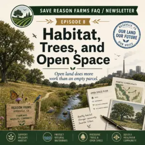
Open land is not “empty.” It is simply working a shift most of us do not see.
The proposed Phillip Road Site project would convert part of a larger City-owned Reason Farms area into a mixed-use development with housing, retail, medical offices, innovation-center uses, parks, trails, utility infrastructure, and a bridge across Pleasant Grove Creek and the Pleasant Grove Creek Bypass Channel. The Draft EIR studies an approximately 176-acre development within a larger roughly 241-acre project site.
The Phillip Road Site parcel is currently zoned as Public/Quasi-Public in the operative General Plan. City documents also confirm that the broader Reason Farms property was acquired for off-channel stormwater-retention basins, habitat conservation, passive recreation, and other essential public purposes.
In other words, this is not a blank parcel awaiting a purpose. The Phillip Road Site is land with a history, a watershed function, a creek corridor, nearby wildlife resources, and several competing public-policy uses.
Pleasant Grove Creek crosses the property from east to west, dividing the site into northern and southern portions. The Draft EIR identifies the Al Johnson Wildlife Area northwest of the project site and describes that area as part of the larger landscape planned to accommodate the Pleasant Grove Stormwater Retention Basin Facility and potential passive recreation.
The project does include proposed open space. The Draft EIR describes parks, trails, and open-space areas along Pleasant Grove Creek and the bypass channel. But open-space acreage on a plan is not identical to preserving the existing condition of a connected landscape. A creek corridor can be retained on paper while its surroundings become brighter, louder, busier, and more fragmented. That is why buffers, lighting design, fencing, drainage controls, construction practices, and long-term management matter as much as the color green on a site map.
The Draft EIR recognizes that biological resources require careful mitigation. It identifies potentially significant pre-mitigation impacts involving special-status plants, special-status wildlife and habitat, riparian habitat, protected wetlands, wildlife movement, and protected trees. The proposed measures include surveys, avoidance requirements, buffers, protective construction practices, stream setbacks, compensation for unavoidable riparian-habitat loss, wetland permitting, and wildlife-friendly building and fencing designs. The Draft EIR concludes that those identified biological impacts would be reduced to less-than-significant levels after mitigation.
That is the City’s preliminary environmental conclusion. It does not mean the biological questions disappear. It means the effectiveness of the result depends on whether the mitigation is specific, timely, enforceable, funded, monitored, and applied to actual conditions found before and during construction.
The California Department of Fish and Wildlife raised related concerns during the earlier EIR-scoping process. CDFW stated that the project area supports Pleasant Grove Creek, tributaries, and associated riparian habitat, and recommended that the EIR fully identify potential effects on stream features, associated vegetation, wetlands, fish and wildlife habitat, sensitive species, wildlife movement areas, and adjacent natural habitats. CDFW also recommended mapping and quantifying areas temporarily or permanently affected by project components such as utilities, access, and staging areas.
The alternatives analysis also reinforces a practical point: footprint matters. The Draft EIR’s Reduced Footprint and Development Alternative would eliminate development on the northern portion of the site and avoid the proposed bridge across Pleasant Grove Creek and the bypass channel. The EIR states that this alternative would reduce impacts related to biological resources, air quality, greenhouse gases, aesthetics, cultural resources, and tribal cultural resources, although it would not avoid every significant and unavoidable project impact.
The public-comment record featured by Save Reason Farms adds the community’s perspective to that technical framework. The library currently includes a general advocacy submission, a Center for Biological Diversity comment letter, and Public Comment Letters #2 through #12.
Together, those comments raise a broad set of questions: whether a potential General Plan amendment is project-driven; whether a proposed 60-inch sewer line reflects unexamined future development; whether transportation works for children walking or bicycling independently; whether “innovation” clearly describes potential uses; whether mitigation is improperly deferred; whether intensive uses belong near homes, schools, and sports fields; whether localized pollution can be addressed through off-site measures; whether mitigation is sufficiently specific and enforceable; whether solar commitments and on-site greenhouse-gas reductions are concrete; and whether future fees, plans, and assumptions shift too much risk onto the public. These are commenters’ positions and requests for further analysis, not City findings.
Not every comment is about habitat. Yet all of them share one question relevant to open land: what will be protected before the bulldozers, bridge, pipes, lighting, and future tenants arrive?
Neighborhood discussion, including on platforms such as Nextdoor, can help identify the places residents value most: creek views, wildlife sightings, walking routes, quiet evenings, drainage patterns, and the sense that the city still has breathing room. Such posts are useful context, not technical evidence. The technical record must come from the EIR, biological studies, engineering plans, agency comments, mitigation-monitoring commitments, and the City’s Final EIR response to public comments.
The City has stated that it will evaluate and address environmental comments in the Final EIR.
That next step should do more than count acres and list mitigation measures. It should show, in practical terms, how the project will preserve creek functions, protect habitat, limit edge effects, manage runoff, and maintain a meaningful relationship between development and the open land around it.
Tomorrow’s open land will not be saved by nostalgia. It will be saved by clear facts, enforceable commitments, and decisions made carefully enough to remain defensible long after the plans are approved.