A Field Is Not a Blank Page
A field does not need a grocery-store label to be doing useful work.
The proposed Phillip Road Site project would transform part of a City-owned, approximately 241-acre property at 6382 Phillip Road into a mixed-use development. The proposal includes residential, commercial, medical-office, park, open-space, and “innovation center” uses, along with roadway work, utility extensions, and a new electrical substation. The State CEQA record describes up to 664 homes and more than one million square feet of innovation-center space.
But before the site became a project diagram, it was land with a working history. The Draft Environmental Impact Report, or DEIR, describes the property as “undeveloped grazing land.” It states that the parcel was planted in the 1950s and remained in rice production through the 1990s; today, it is used for grazing. The DEIR also identifies this public property as Farmland of Local Importance, with two smaller areas mapped as grazing land under the California Department of Conservation’s Farmland Mapping and Monitoring Program.
Those labels matter, although perhaps not in the way many residents might expect.
Under the CEQA significance threshold applied by the DEIR, “Farmland” includes Prime Farmland, Unique Farmland, and Farmland of Statewide Importance. Farmland of Local Importance and grazing land do not fall within that narrower CEQA definition. The DEIR therefore concludes that converting this site would be a less-than-significant agricultural-resource impact and requires no agricultural mitigation. It also states that the property is not subject to a Williamson Act contract and is not zoned for agricultural use.
That is the DEIR’s legal and technical conclusion. It does not mean the land lacks value, history, or planning significance. It means that the CEQA agricultural-resource checklist does not treat its proposed conversion as significant under the stated threshold.
The surrounding landscape provides important context. The DEIR says agricultural land remains immediately west of the project site in Placer County and is actively farmed. It identifies nearby areas mapped as Farmland of Local Importance, Unique Farmland, and Farmland of Statewide Importance. The project site therefore sits at a transition point: existing and planned urban development lie to the east, south, and northeast, while agricultural and open-space land remains to the north and west.
That transition is exactly where sustainable planning matters most. The question is not whether every parcel must remain agricultural forever. It is whether decision-makers fully understand what is being exchanged when grazing land, creek-adjacent open ground, and a rural edge become roads, buildings, lighting, utilities, and new traffic.
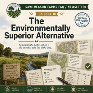
The DEIR’s alternatives chapter shows that the project is not an all-or-nothing proposition. The No Project Alternative would leave the site in its existing condition as undeveloped grazing land, with no new facilities, earthwork, construction activity, or project-generated traffic. The Reduced Footprint and Development Alternative would reduce the developed area from approximately 176 acres to 128 acres, avoid development on the northern portion of the site, and eliminate the proposed bridge across Pleasant Grove Creek and the Pleasant Grove Creek Bypass Channel.
That distinction is worth remembering: a finding of “less than significant” does not mean alternatives are irrelevant. It means the City may still consider the broader design, location, footprint, infrastructure, environmental, and community tradeoffs that accompany a land-use decision.
The public-comment record featured by Save Reason Farms gives those tradeoffs a human voice. The site’s document library currently includes an advocacy submission, a letter from the Center for Biological Diversity, and Public Comment Letters #2 through #12. This is a curated collection, not the City’s official master index of every DEIR comment received.
Collectively, the featured comments raise questions that extend well beyond farming. The advocacy submission challenges whether the DEIR is an adequate informational document. The Center for Biological Diversity urges the City to correct alleged deficiencies. Letter #2 raises a claimed piecemealing concern tied to a proposed 60-inch sewer line; Letter #3 focuses on safe walking and bicycling for students; and Letter #4 questions whether “innovation” adequately communicates the potential range of uses.
Letters #5 through #12 continue the same accountability theme from different angles: mitigation deferred to later plans; neighborhood quality of life; proximity of advanced manufacturing to homes, schools, and sports fields; localized health concerns; specific, feasible, and enforceable mitigation; solar commitments; on-site greenhouse-gas reductions; and reliance on future fees, mitigation, and assumptions. These are the commenters’ views and requested areas of analysis, not findings adopted by the City. But they share a practical question: are the commitments that shape the site’s future clear enough to evaluate before approval?
Neighborhood discussions, including posts on platforms such as Nextdoor, can help identify what residents notice and value: open views, grazing land, creek corridors, wildlife, traffic, school routes, drainage, and the pace of change. Those discussions are useful civic context. They are not, however, substitutes for the DEIR, farmland maps, biological studies, infrastructure plans, or enforceable mitigation measures.
The City’s current project page states that it is reviewing the developer’s application and that the DEIR process evaluates a maximum-impact scenario rather than a guaranteed final buildout.
Sustainable land planning begins with an honest description of the land already there. At the Phillip Road Site, that means recognizing both sides of the record: the DEIR’s conclusion that agricultural conversion is less than significant under CEQA, and the broader civic question of whether this grazing-land edge is being reshaped with sufficient care, clarity, and long-term accountability.